Product 15002
By: Rich Marrano
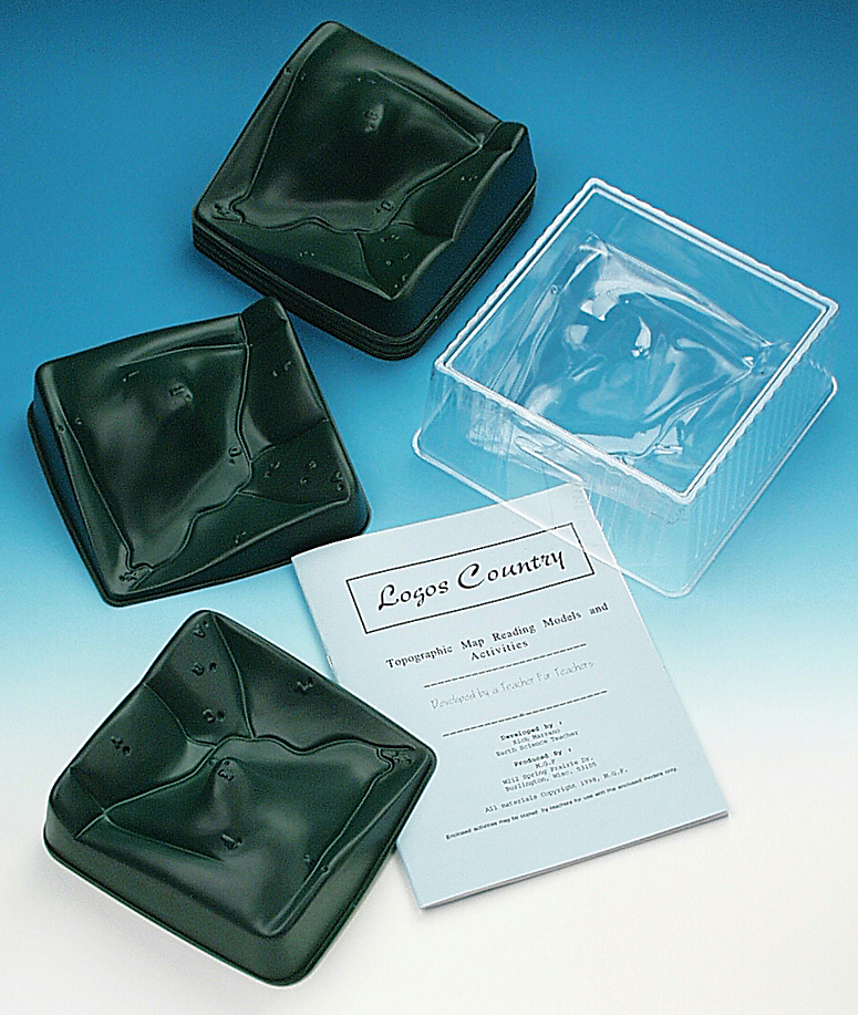
Topography Map Reading Model and Lab Activity for Earth science will give you success at topographic map reading. Innovative kit is a great way to visualize how a three-dimensional land area is depicted in two-dimensions.
See more product details
Options:
(Select option to see volume pricing availability)
Product Details
Give your students success at topographic map reading! This innovative kit, developed by a high school teacher, consists of a teacher demonstration model and 15 student models—your students can observe the overhead projection demonstration and then perform hands-on activities at their own lab stations. Simply give each student group a topographic map and a raised relief model of that map area, place the clear plastic demonstration relief model of the same area on the overhead projector, draw the outline on the board, and begin adding colored water in increments. This activity is a great way for your students to visualize how a three-dimensional land area is accurately depicted in two dimensions and also to gain a clear distinction between horizontal and vertical representations on a topographical map.
Materials Included: Teacher overhead relief model, 15 student relief models, map transparencies and teacher’s booklet containing reproducible student activity sheets. Water, food coloring and an overhead projector are needed but not included.